FLOW TRAIL
Fluid and fast
FLOW TRAIL
Distance:
 3,3 Kms
3,3 Kms
Incline:
 -18,5 %
-18,5 %
Difficulty:
 3+
3+
3+
Elevation:
 172 mts
172 mts
HOW TO RATE THE DIFFICULTY OF A ROUTE OR A BICYCLE CIRCUIT?
TECHNICAL DIFFICULTY:
1- Very easy: A very easy circuit, is suitable for people who can ride a bike on flat asphalt roads and then stop without stumbling. You must have basic notions of braking and shifting. You must have sufficient balance to ride the bike in a straight line without making sudden involuntary maneuvers to the sides.
2- Easy: to pedal on an easy circuit you need to have fluid shifting management that allows you to climb an asphalt slope or pedal on a flat surface without making greater effort, optimizing the energy of your legs at all times. You must also know how to differentiate and use both brakes correctly, the front and the rear.
3- Intermediate: to pedal a circuit of intermediate difficulty, you must master the skills mentioned above, both on asphalt and gravel roads and on low difficulty trails. You must also have an understanding of the correct body position on different terrains and braking precision on slippery terrain and on descents. It is important that you skillfully handle the gear change, both the plates and the sprockets.
4- Difficult: a difficult circuit is suitable for experienced cyclists who know how to pedal on uneven terrain with obstacles, climbs, descents and adverse conditions, such as mud, sand or stones. The cyclist must have good control and control the bicycle at all times, optimizing performance through precise use of gears. It is also necessary to understand how to take advantage of the acceleration of descents to successfully overcome dirt climbs and obstacles such as logs or loose rock.
5- Expert: to master an expert level circuit, it is necessary to train regularly and have physical strength. The pilot must be able to perform jumps and maneuvers at high speed without losing control at any time. It is necessary to master all pedaling, turning and braking techniques on narrow trails with steep slopes of more than 30%, and know how to avoid obstacles such as steps, rocks, roots and slippery ground with mud or dust.
PHYSICAL DIFFICULTY:
We cannot rate the physical difficulty of a bike route, since it strictly depends on the level of training that each person has. As a reference we can say that 35 kilometers by bike is approximately equivalent to 10 kilometers on foot. Circuits with many meters of ascent and gravel surface are more demanding from a physical point of view. In conclusion, we can affirm that a person with an average training, can pedal a distance of 35 to 45 kilometers without major inconvenience, during a period of 4 to 5 hours including rest stops.
If you opt for an e-bike, the physical effort decreases considerably, up to 60% less depending on your riding and pedaling skills.
LOCATION: Cerro Otto
DESCRIPTION
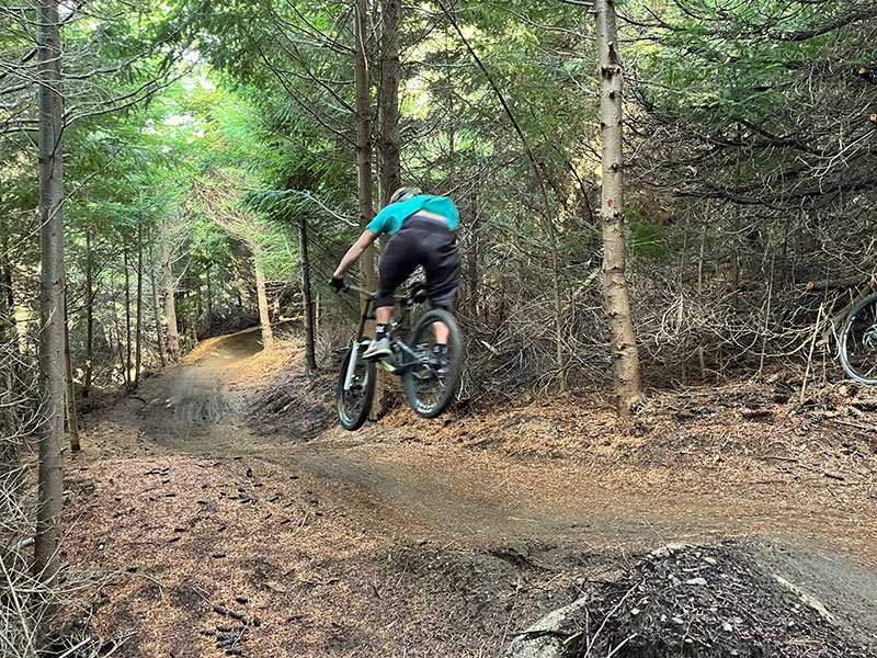
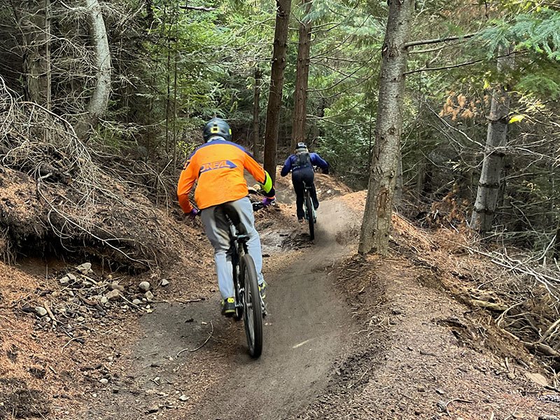
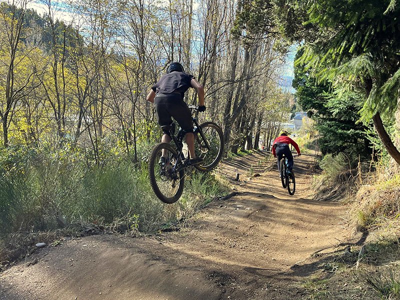
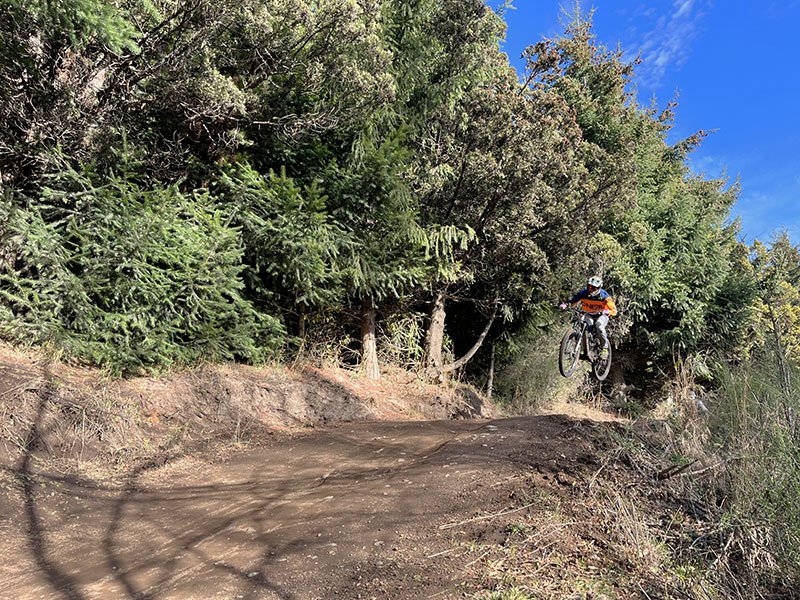
The Cerro Otto Flowtrail was built in 2024. The goal was to create a wider, flowy trail than the traditional Cerro Otto trails, characterized by their high difficulty and narrow layouts. The wide layout allows for alternating between different descent lines. There are several jumps along the way, but none pose a risk if taken at low speed. It’s a suitable trail for getting started in downhill riding and improving your cycling skills. During summer, it is dry and dusty, making the descent considerably difficult.
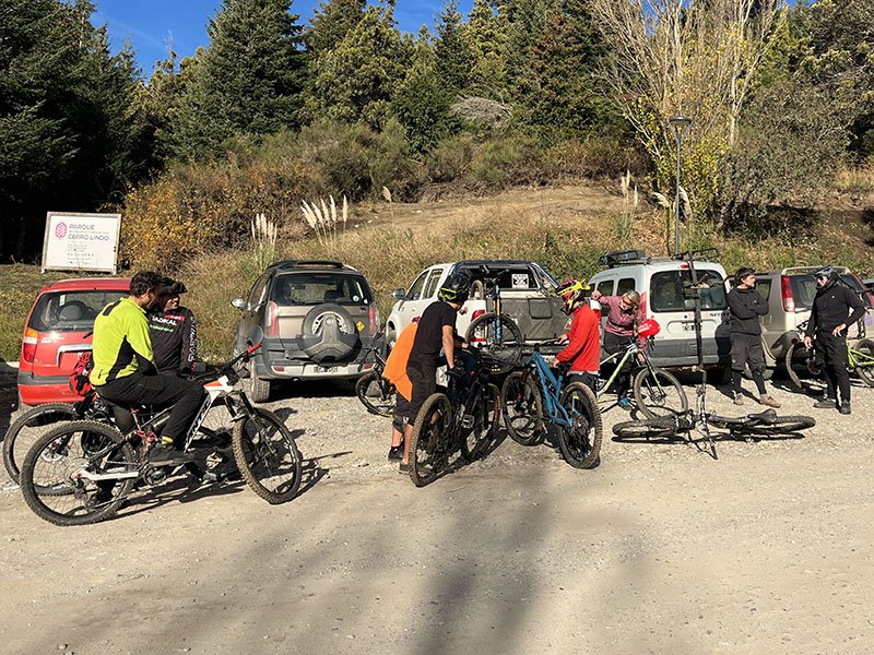
HOW TO GET THERE
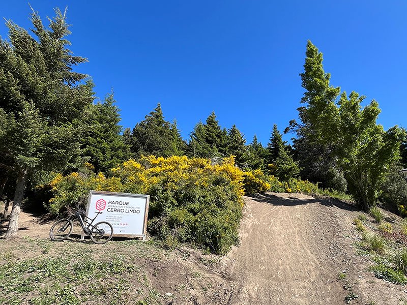
From downtown Bariloche, take Belgrano Street up to Los Pioneros Avenue. At kilometer 1 of this avenue, there is a gas station called YPF El Faldeo. In front of the station, on the other side of the avenue, you should find a sign that says “Cerro Lindo Recreational Park.” Behind the sign, you will find the ascent path, which is shared with pedestrians. This path also leads to the Curva Bariloche area and the start of the “Bosque,” “Piedra,” and “Búho” trails, all of which are more technically difficult than the “Flow” trail.
BICYCLE SUGGESTED

ENDURO

DH


MAPS & GPS
The colors of the circuit indicate the type of surface

Trail

Gravel

Asphalt
To view the trail on your cell phone, you must first download Maps.me app. from GPS APPLICATIONS.
Then download the trail in .KML extension with DOWNLOAD TRAIL button and open it with the app. You will be able to see the track and your relative position without data connection anytime, anywhere.
MOUNTAIN BIKE TRAIL BUILDING
Bariloche’s downhill and enduro mountain bike trails are designed, improved, and regularly maintained by the non-profit organization MTBariloche. Learn more about our work and become part of the community today.
With your monthly subscription, you’ll become part of the community. Your contribution will be used for supplies, tools, materials, transportation, and trail builders’ compensation. The time is NOW. Subscribe by clicking the button.
Rent our bicycles or guide service to ride this trail. Ask about our cycling tours. If you are addicted to cycling trips, explore guided or self-guided multiday tours.